 Facebook: https://www.facebook.com/KernsNA/
 Instagram: https://www.instagram.com/kernspdx/
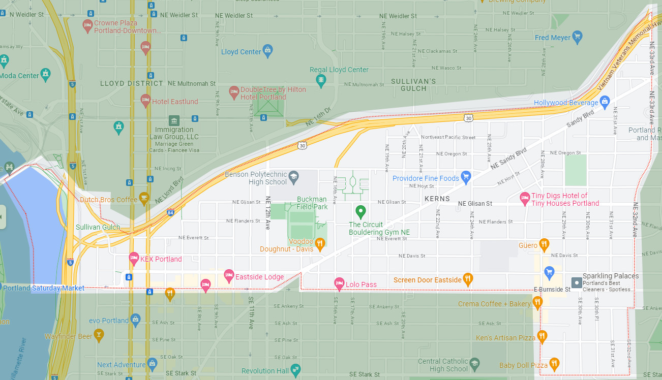
Kerns Neighborhood is in Portland, Oregon – on the inner East Side along the West side of the Willamette River between Burnside Street to the South and I-84 Banfield Highway to the North and 33rd Avenue to the West.
Kerns Neighborhood Association is a public, democratic non-profit organization under the umbrella of the Southeast Uplift District 3 network and fiscal sponsorship. We are residents, workers, business owners and supporters of the Kerns Neighborhood in Portland, Oregon. We are open to all and make decisions democratically. No matter if you are a renter, a homeowner, a worker, a business owner or anyone else who supports the Kerns neighborhood you are welcome and encouraged to join us!
All people in the neighborhood from all walks of life:
Renters, Homeowners, Workers, Business Owners, Guests, Supporters
We do many things to support neighborhood connections and improvements. Below is a partial list.
Kerns Neighborhood Association undertook a Placemaking Initiative in 2021 to clearly identify the Kerns neighborhood to residents, workers and visitors of the neighborhood. We feel that Kerns Neighborhood is a bit of a hidden treasure within Portland with much lower name recognition than other neighborhoods, such as Laurelhurst, Buckman, Sunnyside, etc.
Banners went up in 2023 and 2024 marking the neighborhood.
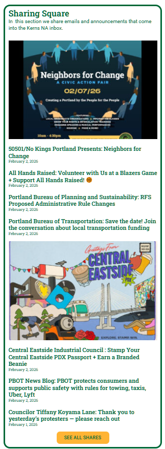
In late 2025 Kerns Neighborhood website added a new section called Sharing Square. Kerns subscribes to many newsletters and lists and gets a lot of emails that are of interest to our community. In the past we shared a selection of these in our monthly newsletter – but there were too many to fit. So in order to share these informative emails and message Kerns started Sharing Square on their website – where these items are posted. This helps inform the community of important updates and upcoming events. https://kernspdx.org/sharing-square/
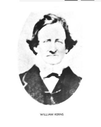
William Kerns, East Mount Tabor’s emigrant homesteader had serious skills with the broad axe. In the 1850s, Kerns cleared his 320-acre Donation Land Claim making mainly wood shingles and shakes for sale. According to a descendant, Kerns could “hew a sill or a beam with the greatest precision and with amazing speed.” In 1855, the East Portland-Mount Tabor School District elected Kerns as their school director. He led the movement to buy land for Washington High School, and later, the board named the school at NE 25th and Everett after Kerns
The Kerns Neighborhood gets its name from the school, and by association, with William Kerns. It’s easy to imagine Kerns, axe in hand, hungry for timber, as he made east Portland’s own Stumptown. We should be careful, though, to judge. After all, his was a practice common for the time, and he was not alone in thinking this was improving the land. What is more fascinating is the story of the neighborhood after.
Following William Kerns’ days with his axe, people replanted as they made the Kerns Neighborhood their home. According to the 2014 Kerns Neighborhood Street Tree Inventory, the neighborhood has 3,140 trees representing 91 different types. There’s actually a good number of large trees throughout the neighborhood (25%). However, it’s easy to see on the map where canopy is lacking. Look no further than Sandy Boulevard. This bustling commercial district bisects the neighborhood diagonally in a northeast-southwest direction. The history of this road is the key to understanding why it lacks mature trees.

 Newsletter:
  Website: